Last updated on July 24th, 2026
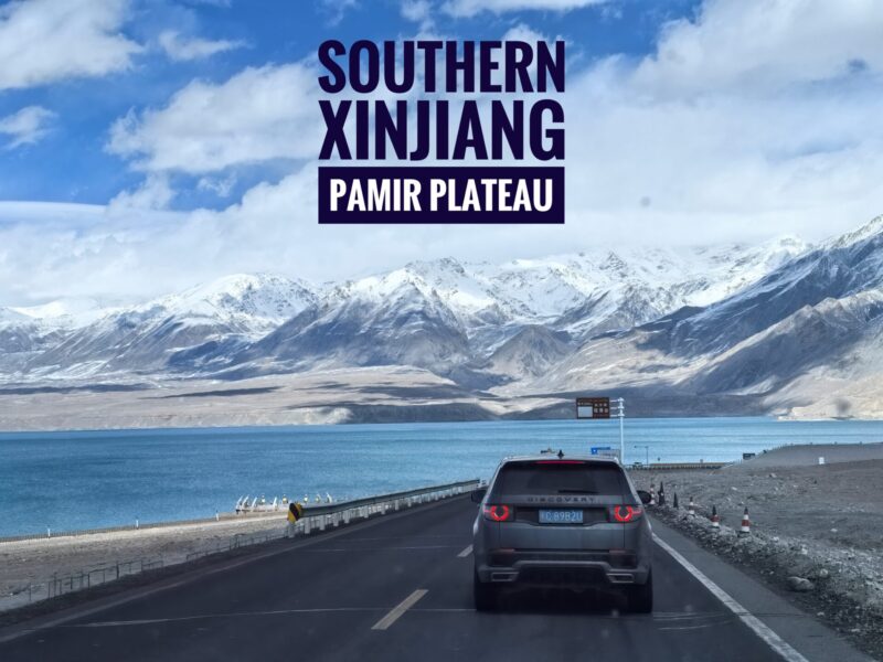
The ultimate Southern Xinjiang Itinerary for an unforgettable Pamir Plateau travel experience, uncovering one of China’s hidden gems.
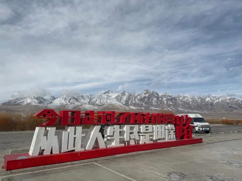
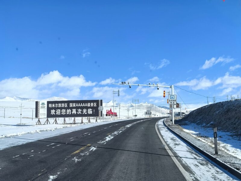
Southern Xinjiang Pamir Plateau (南疆-帕米尔高原) is a stunning high-altitude frontier situated in far western China, where the Tianshan, Kunlun, and Karakoram mountain ranges converge. This region is renowned for its dramatic glacial peaks, pristine alpine lakes, and volcanic wetlands. It is also steeped in history, featuring ancient Silk Road heritage, particularly as the gateway from which the Tang Dynasty monk Xuanzang traveled to India. For cultural and nature enthusiasts, a visit to this Southern Xinjiang Pamir Plateau area is a must.
However, many travelers have expressed concerns about the uncertainties of visiting Southern Xinjiang. To address these concerns, we have compiled our Southern Xinjiang itinerary and created the ultimate travel guide for those looking to explore this amazing destination.
This Southern Xinjiang Pamir Plateau Travel Guide blog includes a variety of activities and attractions in this historically significant landscape, along with practical travel information and useful tips. Let’s check it out.
Southern Xinjiang itinerary – Pamir Plateau Route

Exploring the Pamir Plateau (帕米尔高原) is a highlight of our journey through Southern Xinjiang. This segment of the route is particularly exciting. Most travelers will start their Southern Xinjiang route from Kashgar. It’s advisable to arrive in Kashgar before beginning the Pamir Plateau itinerary, allowing you some time to explore this traditional town.
If you need assistance regarding Kashgar, be sure to check out our Kashgar Travel Guide blog.
Once you enter the Pamir Plateau area, visitors are recommended to rest in Tashkurgan, which is located at an altitude of 3,100 meters. Carrying portable oxygen canisters is also advised. Tashkurgan is the only developed town in the region, so accommodation options are limited. Rooms equipped with oxygen supplies tend to book quickly, so it is best to secure your room in advance.
As always, we recommend booking your accommodation through Trip.com, as some accommodations do not accept foreign visitors.
Southern Xinjiang Pamir Plateau Route Itinerary:
- Pre-trip: Arrive in Kashgar and apply for a border permit.
- Day 1: Travel from Kashgar to Tashkurgan (the Pamir Plateau). Along the journey, visit Baisha Lake, Karakul Lake, and the Stone City Ruins.
- Day 2: Explore the wonders of Tashkurgan, including the Wakhan Corridor, the Panlong Ancient Road, Bandir Blue Lake, Pamir of Eyes.
- Day 3: Visit Muztagh Glacier Park. Lastly, return to Kashgar.
The above Southern Xinjiang Pamir Plateau itinerary is part of our trip to the area and serves as a suggestion for you. There are many attractions to explore, including Oytagh Red Canyon, Oytagh Iceberg Park, and the Muji Mud Volcanoes, where you can customize your own itinerary.
Day 1: Kashgar to Tashkurgan (The Pamir Plateau)
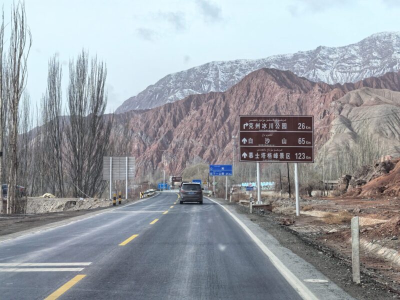
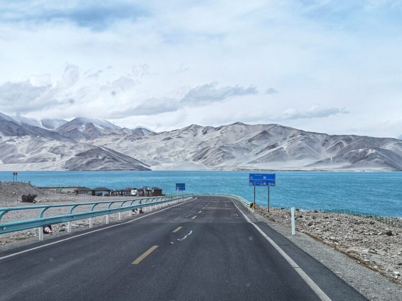
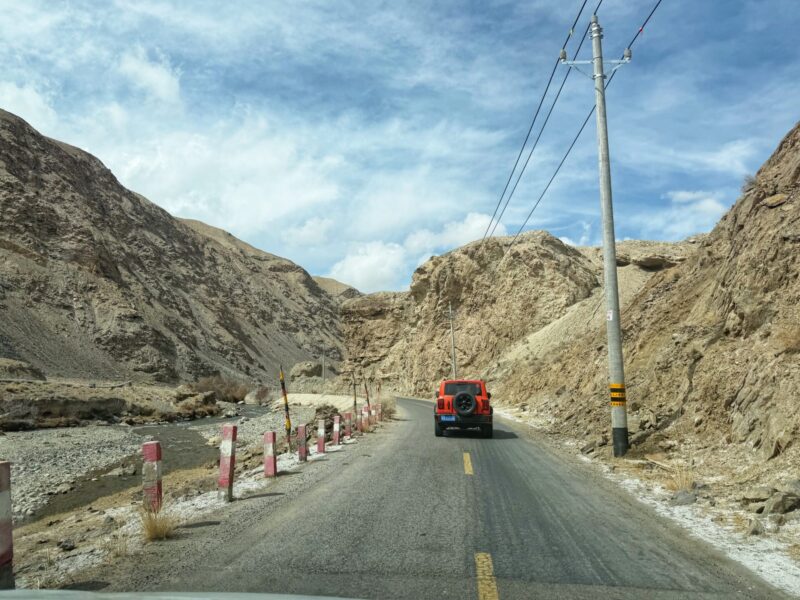
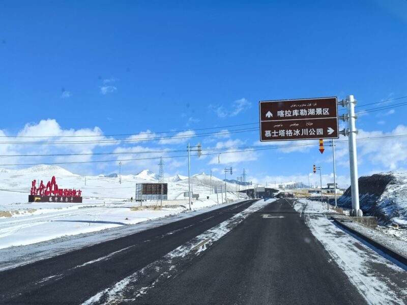
Today, we will embark on the route for the Southern Xinjiang Pamir Plateau itinerary. We will drive along the spectacular Karakoram Highway. The journey will begin in Kashgar (喀什) and end in Tashkurgan (塔县), with several scenic stops along the way.
Day 1: Kashgar to Tashkurgan (The Pamir Plateau)
- Journey: Kashgar (喀什) – Baisha Lake and White Sand Mountain (白沙湖) – Karakul Lake (喀拉库勒湖) – Tashkurgan (塔县).
- Distance/Time: Approximately 300 km (about 5-6 hours by car).
Southern Xinjiang Travel Tips: The altitude is about 3,600 meters. Please be mindful of altitude sickness and bring appropriate wind protection.
Starting your journey earlier will give you plenty of time to deal with unexpected situations, like traffic delays. We left at around 8:30 AM, as we had a lot of distance to cover. Our route included mountainous terrain, and we encountered several security checkpoints along the way.
Our first destination, Baisha Lake and White Sand Mountain (白沙湖), is a 3.5-hour drive from Kashgar.
The scenery becomes truly amazing as you approach the Baisha Lake scenic area. You will be greeted with panoramic views of the sacred mountains and snow-capped lakes of the Pamir Plateau, along with the stunning frontier landscape. It is truly breathtaking!
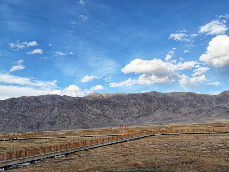
Baisha Lake and White Sand Mountain
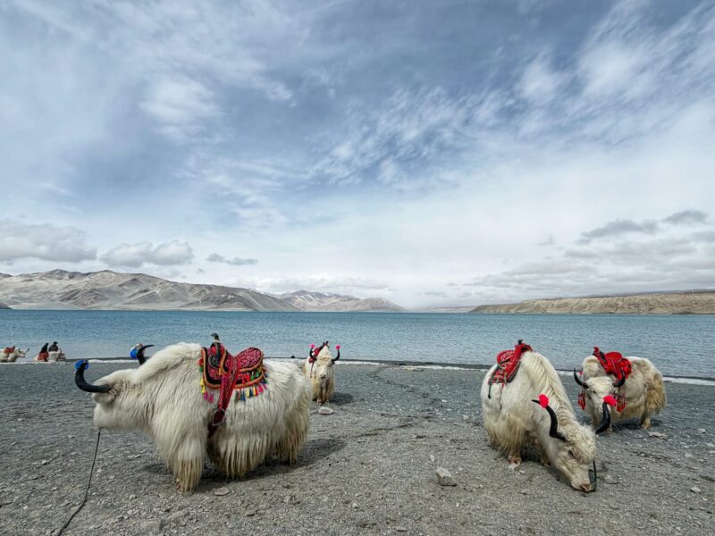
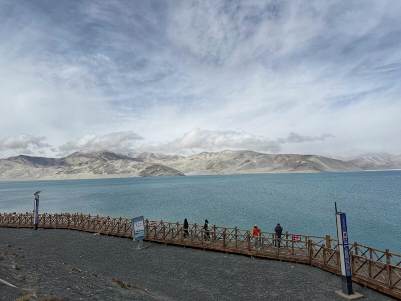
Baisha Lake (白沙湖), located in Southern Xinjiang’s Pamir Plateau, is a pristine spot known for its unparalleled natural beauty. The lively south shore and the tranquil north shore each offer unique experiences waiting to be explored.
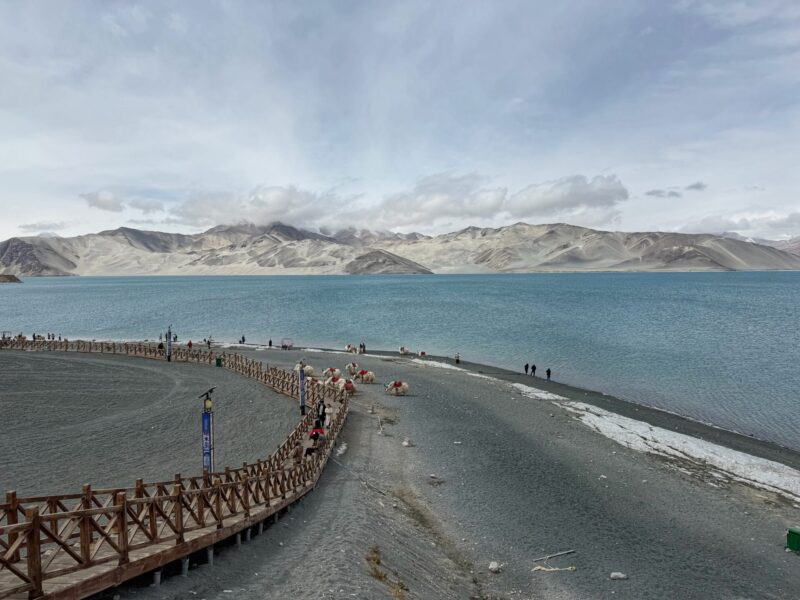
From the entrance, we walked slowly along the hilly wooden boardwalk towards the Baisha Lake scenic area. The scenery was breathtaking, and we took countless photos. Be sure to capture the famous mirror lake shot, featuring the striking reflection of snow-capped mountains.
The striking white-sand shores and backdrop of snow-capped peaks is trully stunning!
There are also people offering yak rides and the opportunity to take photos with the yaks. Prices range from 20 RMB to 50 RMB, depending on the service, so remember to bargain and negotiate for the best deal.
The recommended visit time is about 2 hours, allowing you to fully enjoy the beautiful scenery and capture some amazing photos.
Baisha Lake and White Sand Mountain (白沙湖)
Altitude: 3,300 meters
Getting there: Approximately 160km with 3.5 hours drive from Kashgar.
Suggested Time Spend: Approximately 2 hours.
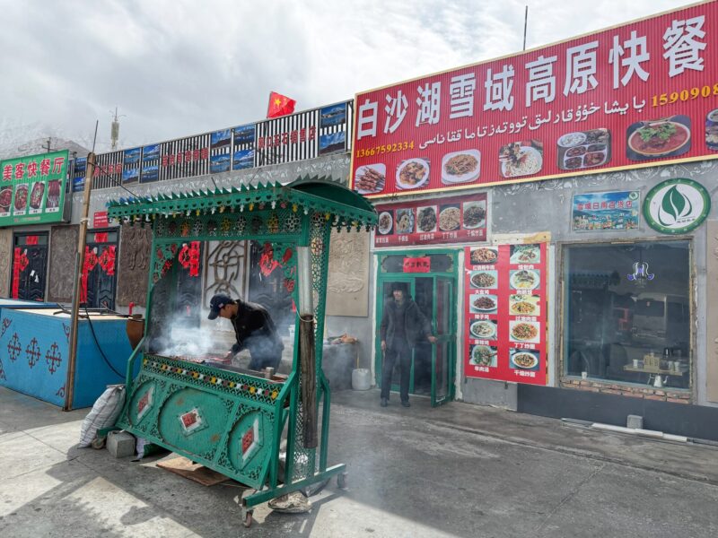
Lunch: Several restaurants at the Baisha Lake Scenic Area that serve Chinese and Xinjiang cuisine. We decided to have lunch here before continuing our journey.
We chose a restaurant that had the most patrons. The restaurant offered a variety of rice and noodle dishes, and the prices were reasonable for the quality of the meals.
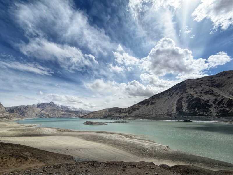
Karakul Lake
Next, we continue our journey to our next destination: Karakul Lake (喀拉库勒湖). The attraction is located just a short drive further south from Baisha Lake, approximately 30 to 40 minutes away.
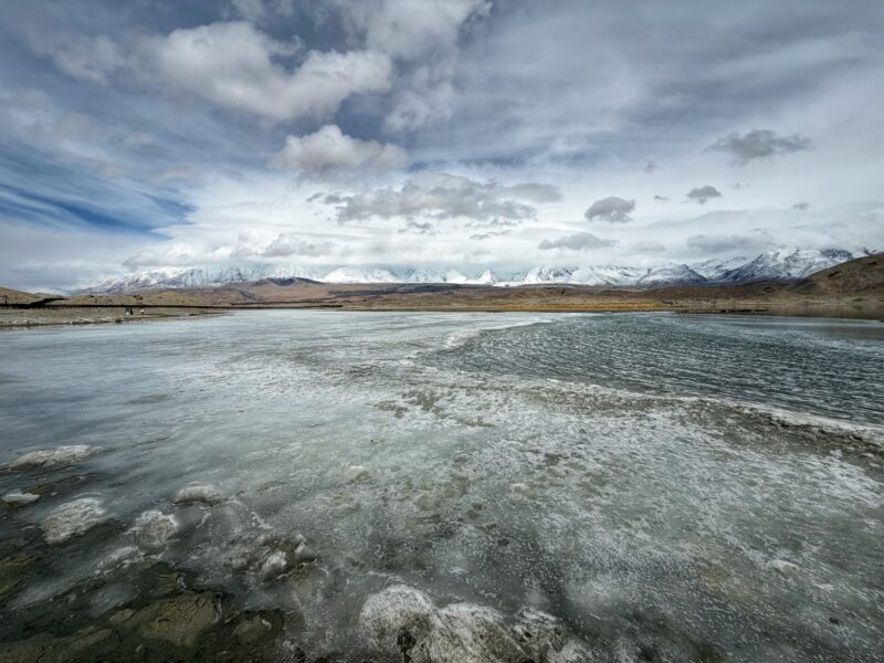
Karakul Lake is beautifully situated at the base of the towering Muztagh Ata peak. This glacial lake is surrounded by snowcapped mountains, set against a blue sky dotted with scattered clouds.
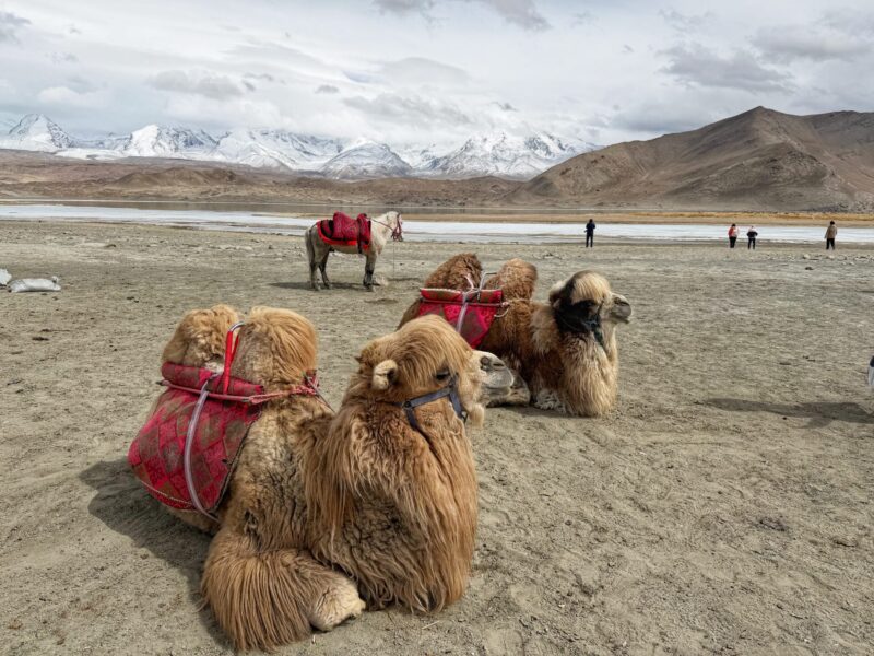
Along the shores of Karakul Lake, you can often spot grazing yaks, horses, camels, and traditional Kyrgyz yurts. The serene scenery captures the breathtaking landscapes typical of Xinjiang, showcasing its tranquil beauty.
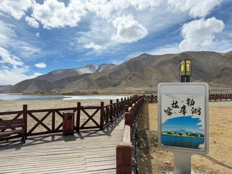
We spend about an hour mesmerized by the surroundings and take plenty of photographs.
Karakul Lake (喀拉库勒湖)
Altitude: approximately 3,600 meters
Getting there: Approximately 30 km with 40-minutes drive from Baisha Lake.
Suggested Time Spend: Approximately 1 hour.
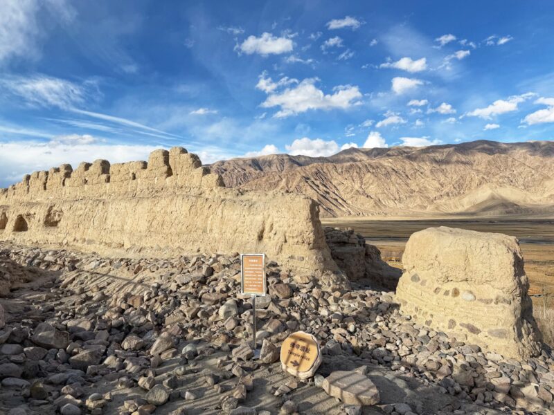
Stone City Ruins and the surrounding Golden Grassland
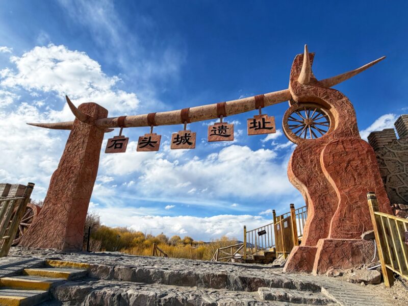
Finally, we arrived in Tashkurgan (塔县). Before taking a rest for the day, we visited the Stone City Ruins and the surrounding Golden Grassland (石头城与金草滩).
Located in the northeastern part of Tashkurgan Tajik Autonomous County, the Stone City Ruins (石头城) stand at an altitude of 3,112 meters and have a history of over 2,200 years. It is one of China’s three major stone cities.
From the entrance, take the sightseeing shuttle to reach the Stone City Ruins.
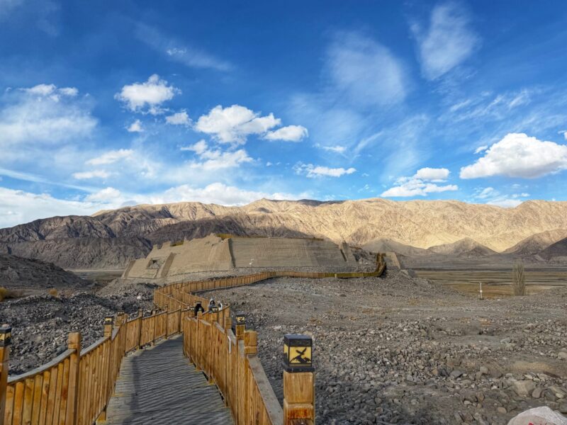
Built atop a hill, the Stone City Ruins consist of the inner city, outer city, Qing Dynasty castle, and remnants of fortifications, with traces of its former grandeur still visible.
As an important stop on the ancient Silk Road, it was once the capital of the Puli Kingdom, one of the 36 states of the Western Regions.
During the Tang Dynasty, it housed a military garrison to secure control of the Pamir Plateau for the central plains. There is also a small museum that showcases the journey of Xuanzang (玄奘). Take some time wandering around the ancient ruins.
Beneath the Stone City lies the picturesque Golden Grassland (金草滩), where the Tashkurgan River winds through the landscape. In spring and summer, the area is lush with vegetation and blooming flowers, while in autumn, the grasslands turn golden under the shimmering sunlight.
The Golden Grassland may not seem very impressive during our early spring visit. We had a quick stop and took the shuttle bus from the Stone City Ruins area.
Stone City Ruins (石头城) and Golden Grassland (金草滩)
Altitude: approximately 3,100 meters
Getting there: Approximately 100km with 1.5 hours drive from Karakul Lake.
Suggested Time Spend: Approximately 1 to 2 hours.
Stay: Accommodation at Tashkurgan

We arrived at our accommodation in Tashkurgan, Xinmei Hotel. This hotel will be our base while visiting the Pamir Plateau.
Xinmei Hotel is a clean and comfortable establishment that offers all the necessary amenities. One of the highlights is that our room is equipped with a diffused oxygen supply, which helps improve air quality and alleviate altitude sickness.
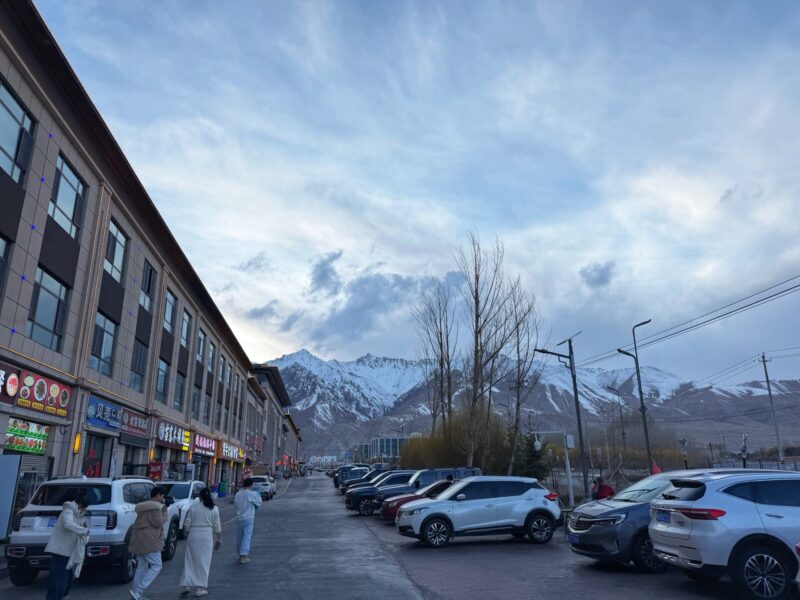
Additionally, there are many nearby restaurants, making it easy to find food. It’s an excellent choice if you’re looking for accommodation in Tashkurgan.
Southern Xinjiang Pamir Plateau Travel Tips: Given that Tashkurgan is located at a high altitude, it’s advisable to choose accommodation equipped with a diffused oxygen supply. There are limited lodging options in the Tashkurgan area, so securing a room with a diffused oxygen supply is highly recommended.
Check for accommodation availability at Tashkurgan
Day 2: The Wonders of Tashkurgan
Our Day 2 itinerary for the Southern Xinjiang Pamir Plateau started late, as we will focus on attractions in Tashkurgan. Today’s highlights include the Wakhan Corridor, the Panlong Ancient Road, and surreal, mineral-rich Bandir Blue Lake.
Day 2: Explore Tashkurgan
- Wakhan Corridor (瓦罕走廊)
- Panlong Ancient Road (盘龙古道)
- Bandir Blue Lake (班迪尔蓝湖)
- Pamir of Eyes (帕米尔之眼)
- Distance/Time: Approximately 220 km (about 4 hours by car).
Southern Xinjiang Travel Tips: There’s also a notable location, the Khunjerab Pass Port of Entry (红其拉甫山口). Unfortunately, this pass is not open to foreigners due to its sensitive location, as it marks the official international border between China (Xinjiang) and Pakistan (Gilgit-Baltistan). The Khunjerab Pass is the highest international border crossing globally, reaching an elevation of 4,733 meters.
Wakhan Corridor

The Wakhan Corridor (瓦罕走廊) is one of the most remote and historically rich borderlands in the world. It is situated in China’s Xinjiang region, nestled between Tajikistan to the north and Pakistan to the south.
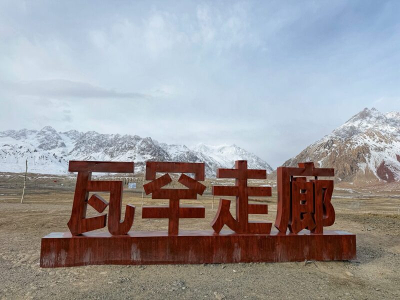
The Wakhan Corridor is located at the intersection of three major mountain ranges: the Pamirs, the Hindu Kush, and the Karakoram. This area is home to approximately 12,000 residents, belonging to two unique ethnic groups: the Wakhi and the Kyrgyz.
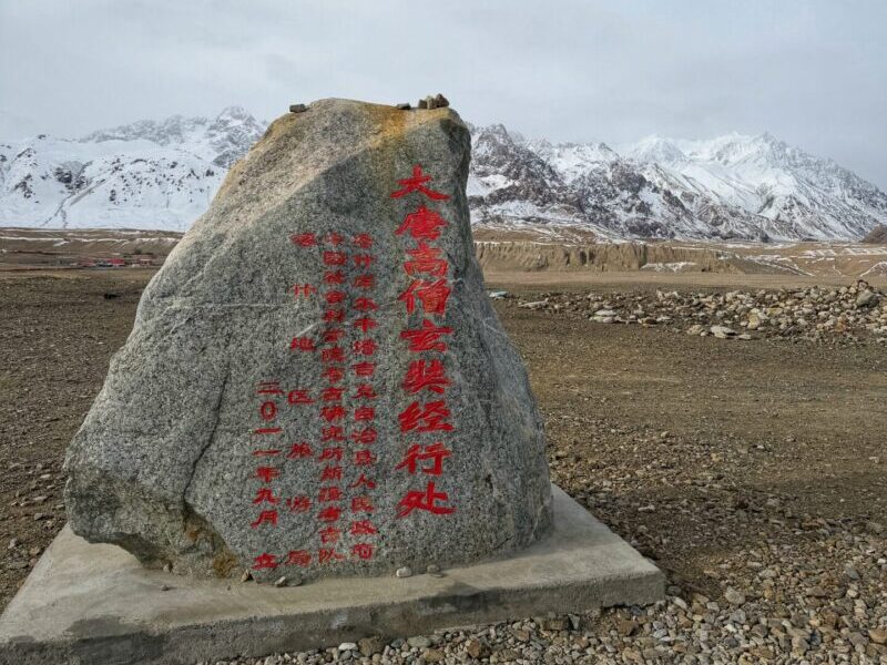
This area was once part of the ancient Silk Road; the Tang Dynasty monk Xuan Zang (玄奘) traveled via this route to India. There are several spots suitable for photography, though they are not particularly extraordinary. We stopped here for about 30 minutes.
Wakhan Corridor (瓦罕走廊)
Altitude: approximately 4,000 meters
Getting there: Approximately 70 km with 1 hour drive from Tashkurgan downtown area.
Suggested Time Spend: Approximately 30 minutes.
Panlong Ancient Road
In the late morning, we continue our journey to the thrilling Panlong Ancient Road.
The Panlong Ancient Road (盘龙古道) is a world-famous highway located on the Pamir Plateau. It is renowned for its over 600 sharp hairpin turns packed into a single mountain pass. Here, you can experience the ultimate challenge of navigating this winding route.
The road features approximately 639 S-curves, U-turns, and hairpin loops, many of which involve dramatic bends of 180 to 270 degrees.
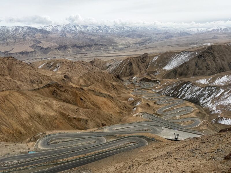
Due to the narrow and exhilarating nature of the road, only small passenger vehicles with seven seats or fewer are permitted. We have split into two small vans for the remainder of our journey. Note that it can be quite dizzying if the driver’s skills are not highly proficient.
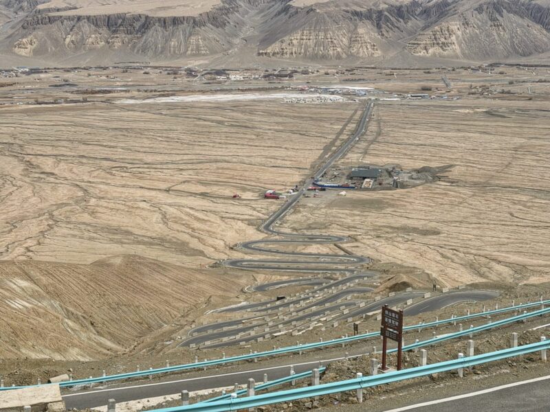
Along the route, there are several stopping points and viewing points where you can take photographs. We spend about 2 to 3 hours at these scenic spots.
Panlong Ancient Road (盘龙古道)
Altitude: approximately 4,200 meters
Getting there: Approximately 50 km with 40 minutes drive from Wakhan Corridor.
Suggested Time Spend: Approximately 2 – 3 hours.
We had lunch at the Panlong meeting point before continuing our journey. There is a row of restaurants, mostly Chinese, in the area. A quick, simple lunch cost us about 20 RMB, which is quite reasonable.
Bandier Blue Lake
Exit the conyon road, it is best to combine a drive down the Panlong Ancient Road with a visit to the nearby Bandir Blue Lake, which is located right at the exit of the pass.
This stunning reservoir, known as Bandir Blue Lake (班迪尔蓝湖), is often referred to as the “Sapphire of the Pamir Plateau” or the “Blue Eye of the Pamirs” due to its breathtaking beauty. The lake is nestled deep within the mountain canyons, making it a hidden gem in the remote Kunlun Mountains.
The water in the lake has a high concentration of mineral sediment. When illuminated by sunlight, the light refracts, creating a captivating array of colors, including pure azure, Tiffany blue, peacock green, and deep navy.
The view is truly breathtaking; however, it does not compare in magnificence with White Sand Lake. We spent around 30 minutes enjoying it.
Bandir Blue Lake (班迪尔蓝湖)
Altitude: approximately 3,050 meters
Getting there: Approximately 60km with 50 minutes drive from Panlong Ancient Road
Suggested Time Spend: Approximately 30 minutes.
Pamir of Eyes
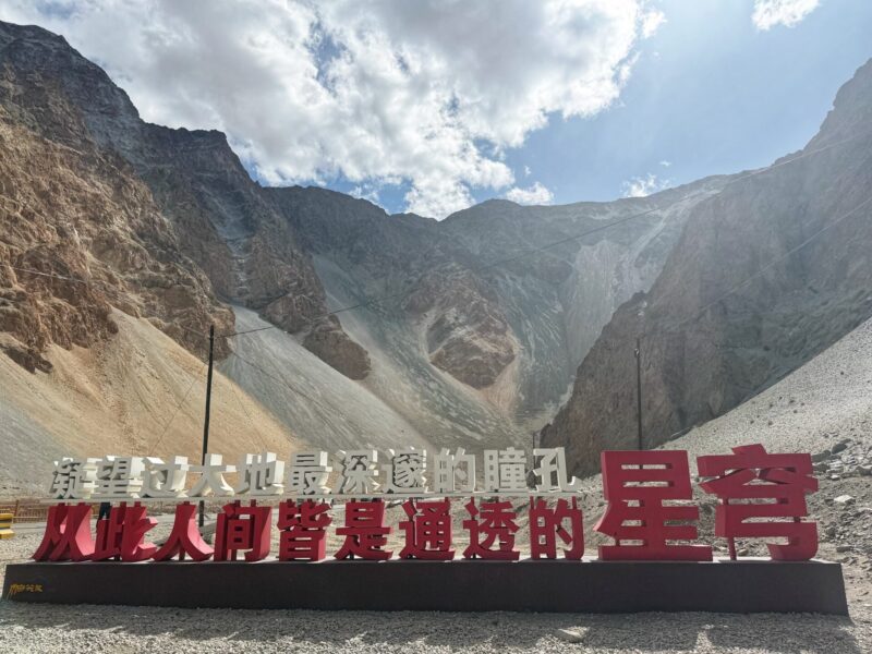
We also visited a small attraction known as the Pamir of Eyes (帕米尔之眼). It showcases a peculiar geological pattern that has naturally formed on the mountainside.
This “Eye” can be seen on the mountainslope as we drove along the narrow canyon road back to Tashkurgan.
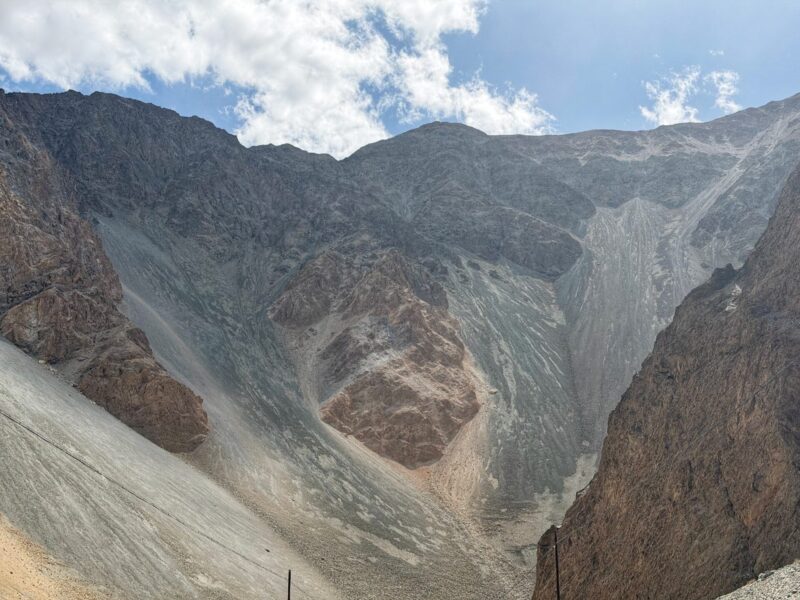
The massive, oval-shaped erosion pattern on the mountain face resembles a giant biological eye. It is approximately one hundred meters wide, staring directly down at the road. We took a break of less than 30 minutes to enjoy this unique site.
Pamir of Eyes (帕米尔之眼)
Altitude: approximately 3,012 meters
Suggested Time Spend: Approximately 30 minutes.
Stay: Accommodation at Tashkurgan
Lastly, we made our way back to the hotel to get some rest. It had been a tiring day, but we enjoyed some unique stops along the drive. Most of the activities involved simply taking in the views, so it wasn’t as exhausting as yesterday. We decided to go to bed early to prepare for the highlight of our route the following day.
Check for accommodation availability at Tashkurgan
Our room is equipped with a diffused oxygen supply, and we have a great rest.
Day 3: Tashkurgan – Muztagh Glacier Park – Kashgar
The main focus for Day 3 is to visit Muztagh Ata Glacier Park, one of the highlights of our Southern Xinjiang Pamir Plateau itinerary that we have been looking forward to.
From Tashkurgan, the drive takes about one hour. Along the way, we stop at a scenic spot called Taheman Wetland, which is a small and free attraction. After that, we spent approximately four hours exploring Muztagh Ata Glacier Park. Finally, we return to Kashgar to conclude the day.
Day 3: Tashkurgan back to Kashgar
- Journey: Tashkurgan (塔县) – Muztagh Glacier Park (慕士塔格冰川公园) – Kashgar (喀什).
- Distance/Time: Approximately 300 km (about 5-6 hours by car).
Taheman Wetland
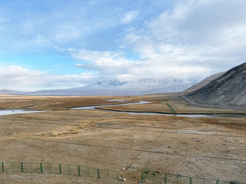
The Taheman Wetland (塔合曼湿地) is a stunning high-altitude alpine wetland located on the Pamir Plateau at the base of Mount Muztagh Ata. Visitors are not permitted to approach the wetland directly; instead, they can enjoy the scenery from a dedicated multi-level viewing platform.
From the viewing platform, travelers can capture views of the mountains, streams, and grazing livestock. We feel fortunate that the weather is quite pleasant, with a patch of blue sky overhead. We’re taking a quick stop before heading to our next attraction.
Taheman Wetland (塔合曼湿地)
Opening Hours: Always open.
Getting there: Approximately 20 km with 30-minute drive from Tashkurgan.
Admission Fees: Free.
Suggested Time Spend: Approximately 30 minutes.
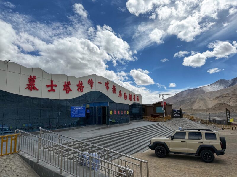
Muztagh Glacier Park
After a quick visit to Tahaman Wetlands, we proceeded to Muztagh Ata Glacier Park (慕士塔格冰川公园). This visit is one of the highlights of our trip to the Southern Xinjiang Pamir Plateau. Within the park, visitors can marvel at colorful and mysterious ice towers and caves, as well as experience the delicate yet harsh beauty of the four-layer ice lakes.
There are two routes you can take to visit Muztagh Ata Glacier Park once you arrive at the mountain base. We opted for Glacier No. 4 Route, as it is the safest option and suitable for our physical fitness level. This is also the standard, commercial park option for general access.
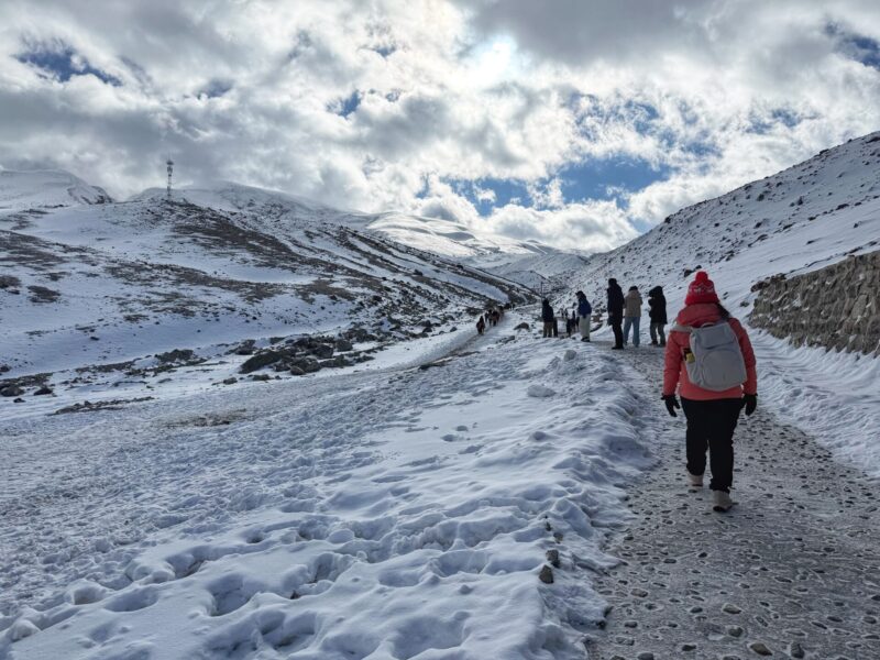
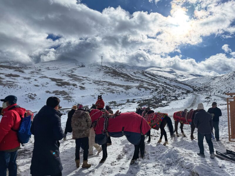
From the entrance, we took a shuttle bus to the base, and then hiked up to the peak. Due to the thin air and high altitude, it’s important to slow down and take more breaks while ascending. If you have weak knees, consider using hiking sticks.
The most challenging aspect isn’t just the steepness of the steps to Muztagh Ata Glacier Mountain Peak, but also the difficulty of breathing and the risk of altitude sickness.
Take note that Muztagh Ata Glacier Park has age Restrictions. Children under 3 years old and seniors over 70 years old are not allowed to enter the park due to the high altitude.
We hiked 800 meters to 1.5 kilometers along a walkway to reach the main glacier viewing platform at 4,688 meters. It was quite tiring. However, the journey up is incredibly rewarding, with stunning views along the way.
There is an optional horse ride available for 100 RMB one way, which can help conserve your energy for the ascent.
Take your time to enjoy the walk. We spent about 40 minutes reaching the top, hiking slowly and stopping frequently to take photos. Once you reach the destination, it is all worth it!
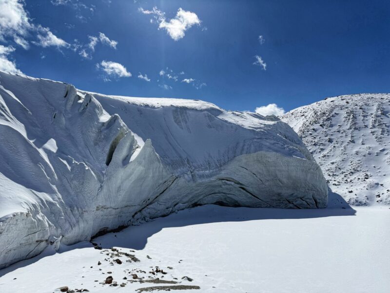
The joy of arriving at Muztagh Glacier Mountain Peak is indescribable.
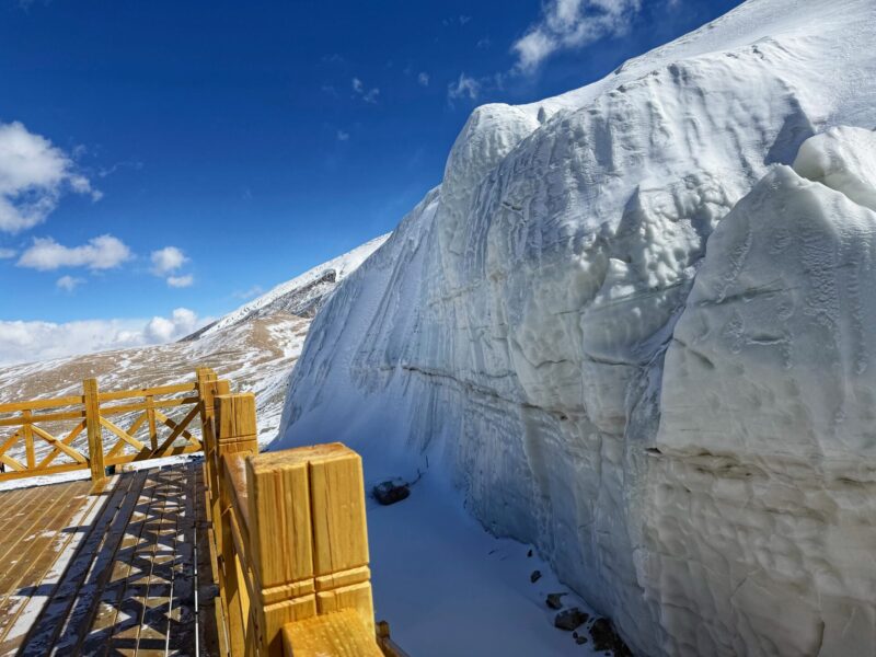
The peak of Muztagh Ata Glacier Mountain is covered in snow year-round, creating a magnificent landscape. Walk closer to admire the Glacier Cliff and the beauty of Glacier Park.
We documented our trip in the Muztagh Ata Glacier Park Travel Guide blog. Check it out if you’re interested in learning more!
Muztagh Ata Glacier Park (慕士塔格冰川公园)
Opening Hours: Daily from 11:00 AM to 6:30 PM (closed during bad weather).
Admission Fees: CNY 43 for the entry and CNY 24 for the shuttle bus.
Getting there: Approximately 50 km with 40-minutes drive from Tahanman Wetland.
Suggested Time Spend: Approximately 4 hours.
Important Southern Xinjiang Pamir Plateau Travel Essential
Last but not least, here are some important and practical travel information for the Southern Xinjiang Pamir Plateau itinerary:
Plan Your Visit: Most attractions in Southern Xinjiang are widely scattered, requiring considerable road traveling time. During our trip, we often traveled for 4 to 5 hours on the road. It is essential to have a reliable tour agency and comfortable transportation to ensure a smooth experience.
Border Permit: Due to the sensitive nature of the location, visitors are required to obtain a border permit to visit the Pamir Plateau in Southern Xinjiang. You will need to apply for a Border Defense Permit (边境通行证) in Kashgar before you start your journey.
High Altitude: Pamir Plateau has an average elevation of over 4,500 meters, making it unsuitable for those with weaker physical conditions or elderly travelers without proper preparation. Temperatures can drop sharply at night, and altitude sickness is a genuine concern.
Overall: Trip to Southern Xinjiang Pamir Plateau
All in all, we hope you enjoy reading our Southern Xinjiang Pamir Plateau itinerary. We have organized the itinerary into two segments based on whether you have 5 days or 10 days to explore the area. While we believe that 4 to 5 days is sufficient to appreciate the beauty of the Pamir Plateau, having more days will allow you to cover more ground. Feel free to check out our Xinjiang itinerary for additional trip planning ideas. Enjoy your adventure in Southern Xinjiang!
Lastly, this Southern Xinjiang itinerary is part of our Pamir Plateau travel blog. Continue reading for more travel stories.